You can almost feel the salt air and hear the waves from your lanai. If you are considering a Portlock oceanfront home, you want clarity on shoreline rules, seawalls, permits, and what truly drives value. This guide breaks down how Portlock’s coastline works, what to verify before you write an offer, and how to plan timelines and costs with confidence. Let’s dive in.
Portlock oceanfront at a glance
Portlock sits on a small peninsula at the east end of Maunalua Bay, at the base of Koko Head. The shoreline is mostly rocky headland with small pocket coves rather than long sandy beaches. Nearshore reefs and the bay’s protected shelf help moderate wave energy compared with more exposed coasts, which shapes how properties live and what maintenance looks like. You can see this shoreline character in NOAA’s coastal geology summaries for Koko Head and Maunalua Bay.
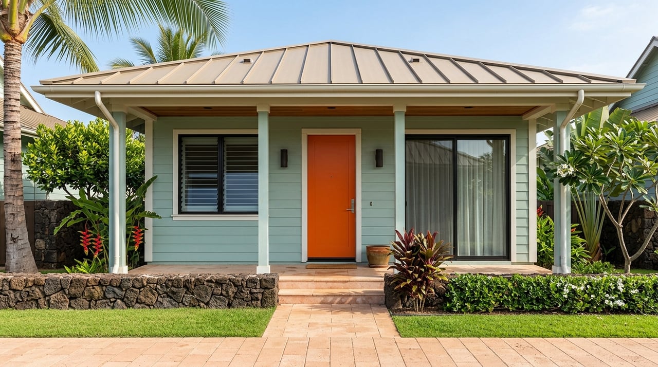
The built footprint is compact, with roughly 100 to 150 residential parcels. Many oceanfront lots are generous by urban Oʻahu standards, and most oceanfront homes are single-family estates set near the shore. Some parcels include older seawalls, revetments, or small private boat facilities. That mix of geology and infrastructure is why careful due diligence matters here.
Privacy and shoreline access
Hawaiʻi law recognizes a public trust in tidelands and a lateral beach transit corridor seaward of the certified shoreline. Private owners cannot permanently block lateral access seaward of that certified line. In practice, Portlock’s rock benches and narrow sand segments limit everyday foot traffic, so privacy still feels high. For any specific parcel, confirm recorded lateral or right-of-way easements and any public-access dedications. For context, review Hawaiʻi’s shoreline public access framework.
Shoreline rules to know
Certified shoreline
The State’s Department of Land and Natural Resources (DLNR), through the Office of Conservation and Coastal Lands (OCCL), administers shoreline certification. A certified shoreline survey establishes the legal shoreline for permitting and setbacks. Always obtain the parcel’s most recent certification and note the date, since certifications can expire or be revised. Learn more about DLNR’s shoreline certification process.
City shoreline setback
The City and County of Honolulu uses a shoreline setback measured from the certified shoreline. On Oʻahu, a minimum 40-foot setback has long been the working baseline in project documents. You should confirm the current setback line for your parcel with the City and verify if any prior certifications exist before finalizing plans. If work would occur within the setback, expect additional reviews or a variance pathway.
SMA and variances
Repairs, additions, or new construction in the shoreline area can trigger the City’s Special Management Area (SMA) review and, where applicable, a Shoreline Setback Variance. Larger projects may require public hearings. In-water or seaward work can also involve DLNR’s Conservation District rules. Multi-agency coordination is common around Maunalua Bay; see examples in Maunalua Bay environmental assessments that reference overlapping state and federal checks.
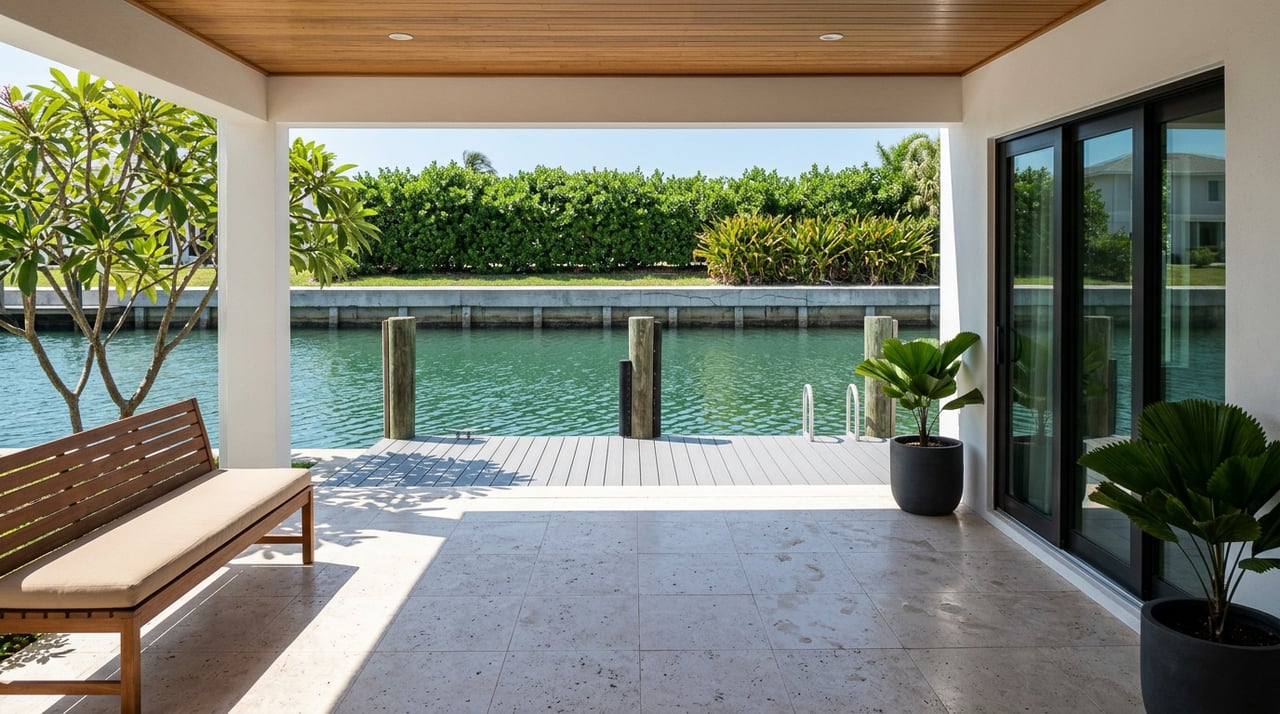
Seawalls, risk, and value
Hawaiʻi’s policy strongly protects natural beach processes and limits private shoreline hardening where it would harm beaches or public access. New private seawalls and similar structures are difficult to approve on sandy segments, and even repairs to older structures are closely reviewed. Review the statewide framework in Hawaiʻi’s Coastal Zone Management policy.
Hard structures can change how waves and sand move. Research shows seawalls often contribute to local beach narrowing and flanking, which can accelerate erosion to adjacent areas. That has real buyer consequences. If a seawall is aging or failing, repairs can be costly, and replacements may face permit hurdles or be denied if they would further fix the shoreline. Independent coastal engineering review is essential; see peer-reviewed research on seawalls and erosion.
Sea level rise and insurance
State and county planning now use sea-level-rise scenarios for coastal review. As a buyer, screen the property in recognized SLR tools and review FEMA flood maps, FIRM panels, and any Elevation Certificates. Flood insurance pricing under Risk Rating 2.0 depends on factors like elevation and proximity to water, so obtain property-specific quotes early. Budget for potential flood and structure coverage as part of your annual carrying costs.
Permits and typical timelines
Common approvals that oceanfront buyers encounter include:
- Shoreline certification through DLNR/OCCL when recent certified shorelines are not on record.
- City SMA permits and, where applicable, Shoreline Setback Variances for work in the shoreline area.
- Conservation District use review by DLNR/OCCL for any work seaward of the certified shoreline or within State Conservation lands.
- Federal U.S. Army Corps Section 404/10 permits and State DOH Section 401 Water Quality Certification for in-water work.
Timelines vary with scope. Small, clearly landward repairs can take weeks to a few months. Work that touches the shoreline area or involves SMA, Conservation District, or in-water permits commonly stretches to many months or more than a year once surveys, engineering, environmental studies, and agency coordination are included. Multi-agency review and public hearings can extend schedules, as illustrated in Maunalua Bay environmental assessments.
Costs to budget
Seawall maintenance or patching can reach into the tens of thousands of dollars. Rebuilds, engineered revetments, or beach-restoration projects often run into the hundreds of thousands to millions after you account for engineering, permitting, monitoring, and possible mitigation. Agencies increasingly prefer softer approaches and nourishment where appropriate, which can add planning and monitoring costs. For a sense of the process and expectations, see the State’s Small-Scale Beach Restoration Program.
Market snapshot for Portlock
Island-wide, Oʻahu’s single-family median remained elevated through 2024 and into 2025, with inventory rising in many months, which gave buyers more leverage in some segments. See the latest Oʻahu market report for high-level trends.
Portlock’s oceanfront is its own micro-market. Inventory is scarce, often in single digits. You will see price dispersion: well-maintained or newly rebuilt estates trade at multi-million levels, while older tear-down candidates can create lower entry points. Because so few oceanfront homes sell each year, median prices can swing. Properties with documented, permitted shoreline structures or clear, transferrable boat-use rights tend to command stronger pricing because conveyance risk is lower. Always verify any dock, slip, or mooring rights in title and permits. If you are also considering marinafront options in Hawaii Kai, this guide to marinafront living in Hawaii Kai outlines how dock rights work in practice.
Buyer checklist for Portlock
Before you write an offer, assemble a focused due-diligence packet. Prioritize these items:
Title and recorded items
- Request a preliminary title report. Ask for recorded easements or maintenance agreements tied to any seawall, dock, or lateral access. Note any CCRs or AOAO rules that affect shoreline maintenance.
Shoreline and survey
- Obtain the most recent certified shoreline map and certification date. If none exists, include a contingency for a buyer-ordered shoreline survey and DLNR certification.
Permitting history and enforcement
- Ask for all permits and approvals related to shoreline structures: City building permits, SMA or shoreline setback variances, DLNR/OCCL files, and any federal or DOH water-quality authorizations. Request any correspondence regarding shoreline issues and check for enforcement notices.
Structural and coastal reports
- If a seawall or dock exists, require a recent structural assessment and a coastal-process memo addressing flanking risk, undercutting, and armor condition.
Elevation, FEMA, and insurance
- Get FEMA FIRM panels, any Elevation Certificate, and quotes from NFIP and private flood carriers. Ask for the property’s flood-claim history.
Shared seawalls
- If the seawall is shared, obtain the recorded cost-sharing agreement and recent invoices. If no agreement exists, consult a title attorney on practical cost allocation.
Docks and moorings
- Verify whether any dock or mooring conveys and under what instrument. Confirm agency approvals, channel depths, and suitability for your vessel. For marinafront context, review the guide to marinafront living in Hawaii Kai.
Photographic and tidal evidence
- Request photos of the shoreline at different tides and seasons, plus historical aerials. Look for signs of storm damage, scouring, and seasonal change.
Environmental and cultural
- Check whether SMA coverage, archaeological, or habitat issues have been flagged in past filings. Ask whether marine resources like coral or turtle use could limit in-water work.
Contract contingencies
- Include contingencies for acceptable title exceptions, a current certified shoreline, a favorable coastal engineer report, documented permits for any shoreline structure, insurability at acceptable cost, and a survey/elevation confirmation. Work with a local real estate attorney for precise language.
How we help you buy smart
Portlock oceanfront transactions reward preparation. You will benefit from coordinated experts and a steady hand on permits, engineering, insurance, and negotiations. With a concierge, team-first approach backed by Sotheby’s global reach, we help you source, evaluate, and secure the right property. We coordinate surveyors, coastal engineers, inspectors, designers, and attorneys so you move forward with clarity. If you are weighing multiple Hawaiʻi Kai or East Honolulu options, we will compare true carrying costs, timeline risk, and lifestyle fit so you can choose with confidence.
Ready to explore Portlock with a trusted local advisor? Connect with Jenn Lucien for a tailored consultation.
FAQs
What makes Portlock oceanfront unique on Oʻahu?
- It is a compact peninsula with a mostly rocky shoreline, pocket coves, and a reef-sheltered bay that moderates wave energy compared with more exposed coasts, which influences maintenance and daily living.
How does Hawaiʻi’s shoreline access law affect Portlock owners?
- Areas seaward of the certified shoreline are public, so owners cannot permanently block lateral access there, though Portlock’s rock benches often limit practical foot traffic and keep privacy high.
Can you rebuild or extend a seawall on a Portlock lot?
- It depends on permits and policy; Hawaiʻi generally discourages private shoreline hardening that harms beaches or access, and even repairs face close review, so approvals are not guaranteed.
How long do shoreline permits take in Honolulu?
- Clearly landward repairs can be completed in weeks to a few months, while projects in the shoreline area or in-water can take many months to more than a year due to surveys, studies, and multi-agency reviews.
What insurance should Portlock oceanfront buyers expect?
- Expect to evaluate flood and structure coverage; pricing under Risk Rating 2.0 is property specific, so obtain quotes early and review any Elevation Certificate to understand carrying costs.